


2017年6月24日中国四川省の新麿村山崩れについて
- 災害調査報告
Xinmocun Rock avalanche induced by rainfall in Songping area, Maoxien, Sichuan, China, 24 June 2017
Masahiro Chigira1), Wu Xiyong2), Zhao Siyuan1)
1) Disaster Prevention Research Institute, Kyoto University. 2) Southwest Jiatong University
June 28, 2017
A large rock avalanche with a volume about 8 million m3 was induced 6 am, 24 June 2017 in Xinmocun village, Maoxien, Sichuan China (Figs. 1, 2). Chinese TV news reported over 100 people are missing or dead. We had been studying this area for years before this landslide and now recognize that the new landslide is the retrogression of a previous landslide scar and remobilization of the old landslide deposits in the lower portion of the slope.
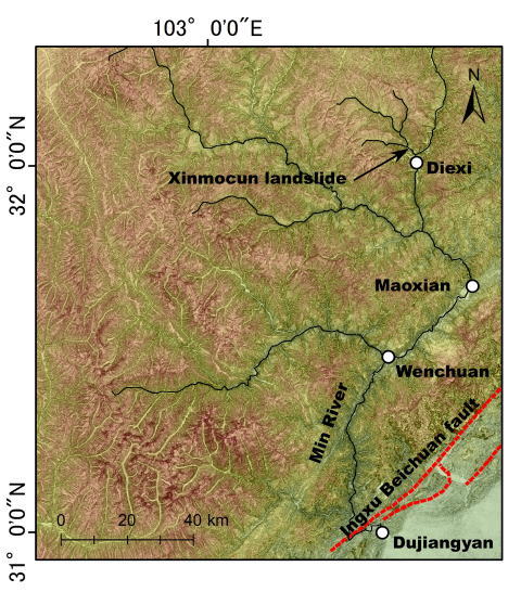
Fig. 1 Location map of the Xinmocun landslide.
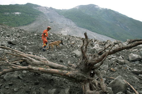
Fig. 2 Xinmocun landslide (Image via Herald Net (AP/N1 Han Guan), through the landslide blog of AGU).
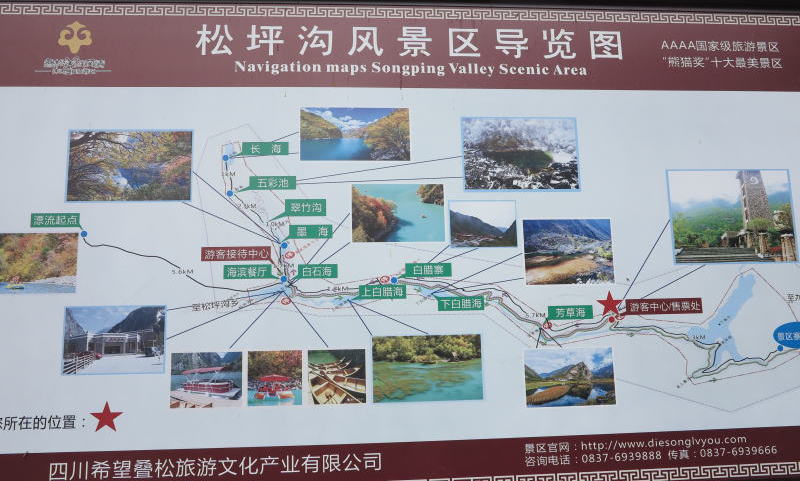
Fig. 3 Sight seeing panel, which shows landslide dams and lakes. The right most lake is the lake of the Diexi landslide. The Cinmocun landslide is located to the left of the red star.
Geologic setting
The new landslide is located in the upstream of the Min River Sichuan China (Fig. 1). The riverbed elevations range from 2000 m to 2500 m and the elevations of nearby ridges 3500 m to 4000 m.
There are many landslide dams in this area, which is a sight seeing spot called Songping area (Fig. 3). A few kilometer downstream of the Cinmocun landslide is the largest landslide dam of the Diexi landslide, which partially failed to form a new landslide dam during 1933 Diexi earthquake. It was partially breached to cause a flood downstream but this dam lake is still remaining as the largest lake in this area.
Bedrock in this area consists of Triassic sedimentary rocks, which are now metamorphosed to be psammitic, pelitic, or calcareous schists.
Xinmocun landslide
The Xinmocun landslide occurred on a SW-facing slope and buried a village on a previous landslide deposits on the riverbed (Fig. 4). The riverbed at the landslide site was 2200 m and the ridge top of the landslide was 3800 m from 5-m DEM of AW3D (ALOS World 3D topographic data).
The bedrock in and around the Xinmodun landslide consists of alternating beds of psammitic and pelitic schists, which are commonly calcareous and show dissolution features (Fig. 5). The beds trend E-W, slightly obliquely to the slope trend, and dip to S at 48 °, steeper than the slope.
The source area of the 2017 landslide was rather small as is shown in Figure 4, judging from the images taken after the event. However, the whole landslide area became very large, larger than the previous landslide. It could be attributed to the energy of the rock mass that rushed down from the source area. The rock mass hit the old landslide deposits 400 to 800 m below and probably mobilized them, which flew over the flat land.
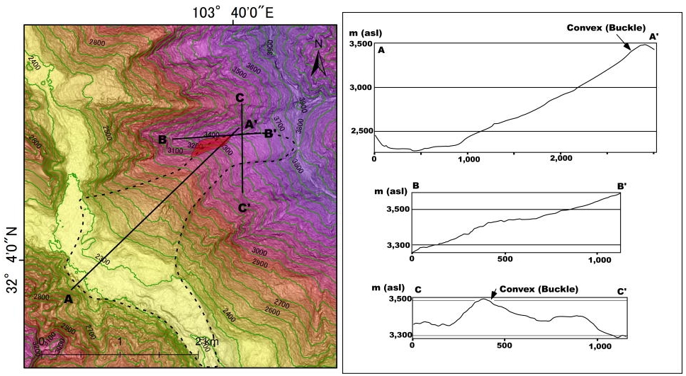
Fig. 4 Topographic map and profiles of the Xinmocun landslide made from the 5-m DEM of AW3D. Dashed line delineates the old landslide and the red area indicates the source area of the rockslide of 2017 landslide. The depositional area of the new landslide seems to be larger than that of the old landslide, but it cannot be clearly delineated now..
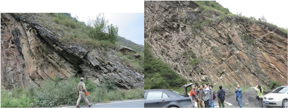
Fig. 5 An outcrop of alternating beds of psammitic and pelitic schists. This outcrop is just on the west of the landslide. We see many holes up to a few tens of cm in diameter, which are made by the dissolution and removal of calcareous material. The beds just above the person in the left picture are slightly buckled to have a convex hinge.
The landslide slope before the 2017 event showed planar rock surface parallel to the bedding in the middle and upslope (Figs. 6A and 6B), and had landslide deposits in the lower part (Figs. 4 and 6A); The planar surface was the sliding surface of the old landslide. We observed small buckling deformation on an outcrop to the west of this landslide (Fig. 5) and also observed nearly horizontal fractures on the planar rock surface (Fig. 6B), which may be buckled portions of beds. We observed buckle folds at the foot of the slope of the old landslide (Fig. 6D), which could be a part of the old landslide body but it remained after the 2017 landslide.
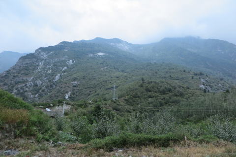
Fig. 6A Overview of the landslide of Xinmocun taken in 2016. Leftside outcrops are stationary bedrock. The heave in the lower right is landslide deposit.
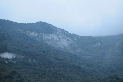
Fig. 6B Planar rock surface parallel to the bedding. We see horizontal trace of fractures near the top of the ridge.
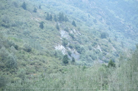
Fig. 6C Lower part of the slope of the old landslide. We see bedding surface, which is buckled to have sharp bends. This portion remained as similar outcrops after the 2017 landslide. Looking from the west.
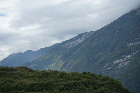
Fig. 6D Upper part of the old landslide. We see planar bedding planes.
Precursory features before the 2017 event
Comparison of geologic features before and after the 2017 event is possible using the Google earth image and the photograph taken by Xu Qiang of Chengdu University of Technology.
Figures 6 and 7 are Google earth images of the whole landslide site and of the ridge-top portion before teh 2017 event. We clearly see a buckle fold hinge just below the ridge top and cracks running parallel to the maximum slope (Cr2 and Cr3). Figure 8 compares the ridge-top portion before and after the 2017 event, which strongly suggests that both sides of the source area of the 2017 rockslide was already bounded by Cr1 and Cr3 before the event and Cr1 became a high steep scarp, which bounded the west of the major volume of the source area.
The buckle fold hinge and the cracks described above clearly suggest that the rocks in the source area of the 2017 landslide had been already gravitationally deformed and prepared for the future rock slide. I assume such a gravitational slope deformation could have been detected by airborne LiDAR.
When we carefully look at the photograph of the sliding surface of the 2017 event, we recognize small holes (Fig. 9), which likely were the result of the dissolution of calcareous materials like those in Fig. 5. Dissolution of calcareous materials forms openings, which are generally connected to each other so increase the permeability and decrease the chance of pore pressure build upt. However, if the connectivity is not so good or rainfall amounts are too much, pore pressure likely builds up .
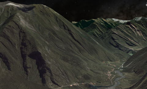
Fig. 6 Google earth image of the whole landslide before the 2017 event.
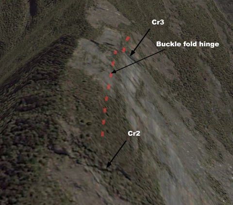
Fig. 7 Google earth image of the ridge top of the old landslide before the 2017 event. We see a buckle fold hinge (red dashed line) and cracks (Cr2 and Cr3).
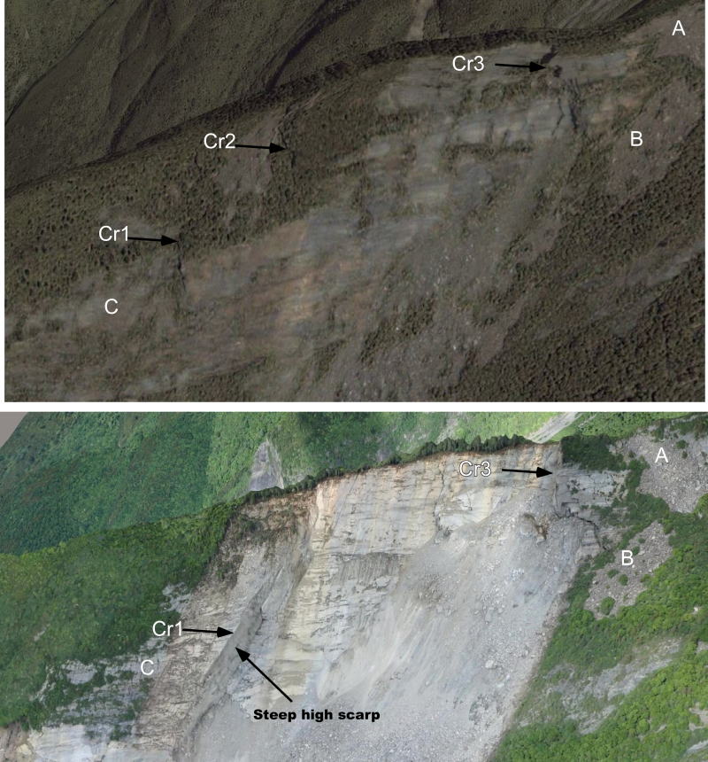
Fig. 8 Ridge-top portion of the 2017 landslide before (upper, Google earth) and after (photo by Xu Qiang) the event. A, B, and C are markers. Cr1, Cr2, and Cr3 are cracks, which were already identified before the landslide. Cr1 became the major border of the 2017 landslide and made a steep high scarp, which bounded the west side of the source of the landslide.
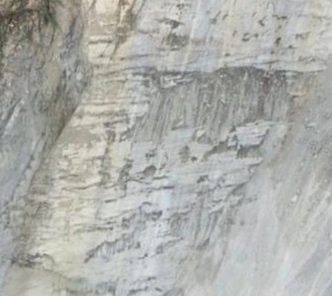
Fig. 9 Holes on the sliding surface (central portion of Fig. 8). These holes are probably due to the dissolution of calcareous materials like those in Fig. 5.
Concluding remarks
The landslide of 2017 occurred on the same slope of a previous landslide. We supposed that unstable rock mass had already slid off, but there occurred buckling deformation and cracking of beds behind the landslide scar to prepare for the next landslide even though rock debris were not remaining in the source area. Now, we know that a sequential phenomena could occur in such a cataclinal slope of calcareous psammitic and pelitic schist alternations. In addition, even a source volume is not large, when it hit the older landslide debris much lower than the source, the rock debris may be mobilized and likely cause a catastrophic disaster.
After the June landslide, there still remain a large amount of rock debris on the sliding surface in higher elevations, which must be monitored because they may be remobilized in future. The height of the landslide is over 1000 m, so kinetic energy of rock debris from the higher elevations would be so high that they hit the downslope accumulation of debris to much increase its volume.