2024 Noto Peninsula Earthquake
Outline
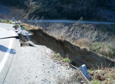
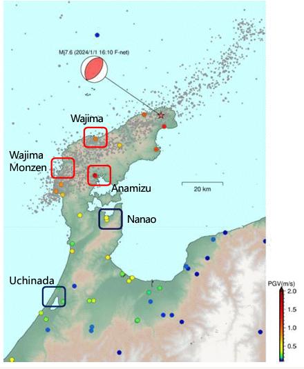
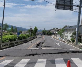
The Disaster Prevention Research Institute (DPRI), Kyoto University has begun investigating the earthquake that took place in Noto Peninsular on 1 January 2024.


The Disaster Prevention Research Institute (DPRI), Kyoto University has begun investigating the earthquake that took place in Noto Peninsular on 1 January 2024.
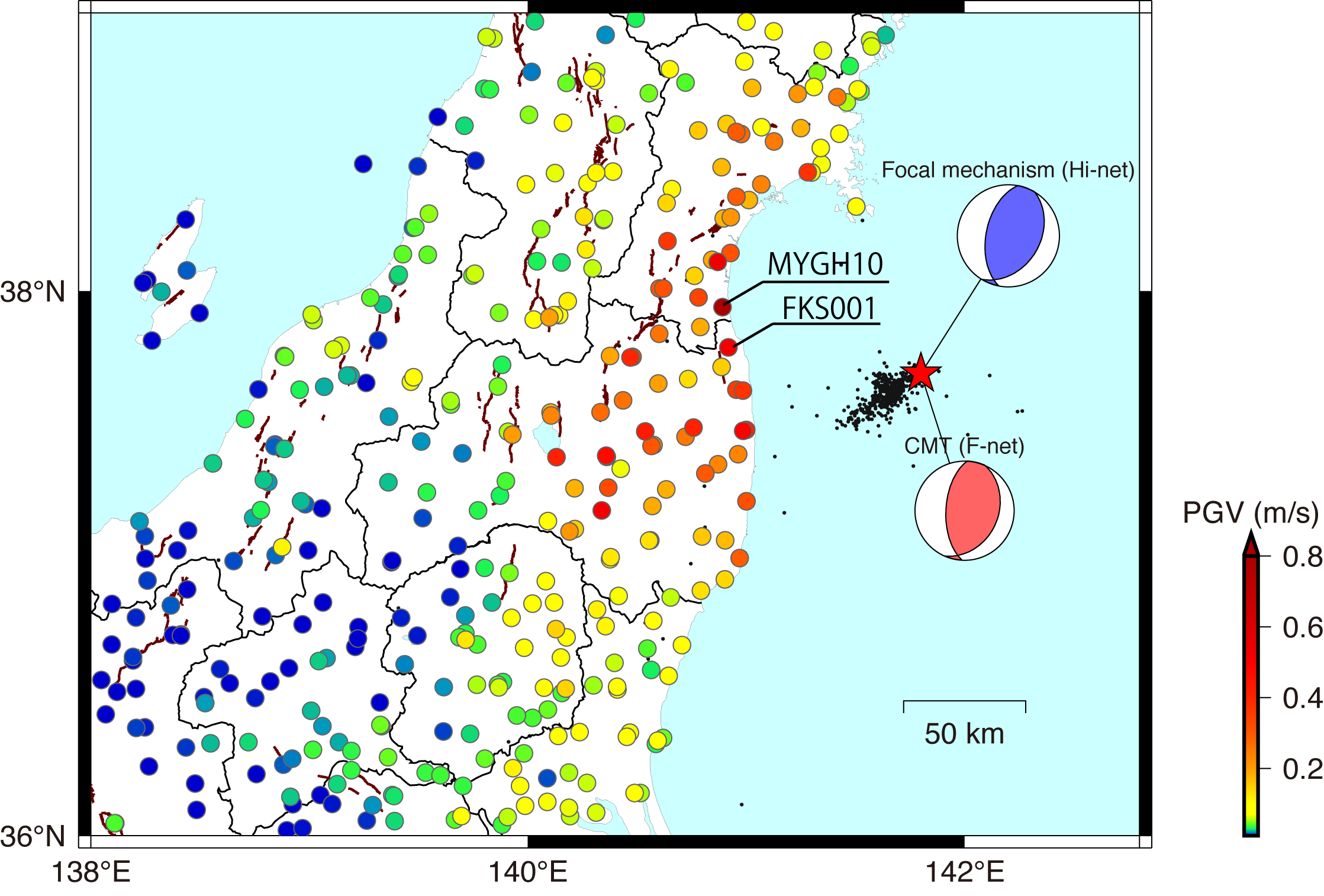
An earthquake of Mj7.4 occurred at 23:36 on 16 March, 2022 at locat time (UTC: 14:36, 16 March), with the epicenter in the off Fukushima, Japan. The depth of the hypocenter is estimated to be about 57 km.
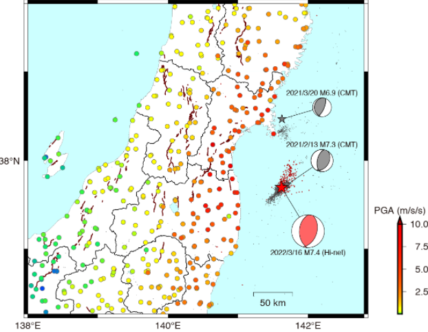
A significant earthquake of Mj7.3 occurred off the coast of Fukushima Prefecture at 23:08 on February 13, 2021 at locat time (UTC: 14:08, Feb. 13). The depth of the epicenter is estimated to be about 60km.
Typhoon Hagibis crossed the Japanese Islands from 12 to 13, October 2019, and brought record‐breaking rainfall and strong wind. This typhoon induced river floods and landslides in eastern Japan and caused tremendous.
The Arson Fire in the 1st Studio of Kyoto Animation was occurred on the morning of 18 July 2019. The arson killed at least 36 people, injured an additional 33, and destroyed most of the materials and computers in Studio 1.

In late June through mid-July 2018, successive heavy downpours in southwestern Japan resulted in widespread, devastating floods and mudflows.
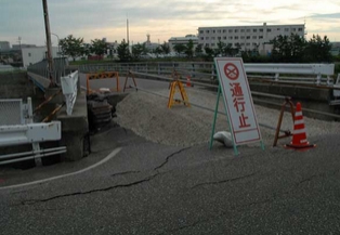
On 18 June 2018, around 7:58 a.m. Japan Standard Time, an earthquake measuring 5.6 Mw on the moment magnitude scale (preliminary 5.5 Mw) struck in northern Osaka Prefecture, Japan. The earthquake’s epicenter was near Takatsuki and occurred at a depth of approximately 13 kilometres. The Japan Meteorological Agency registered a magnitude of 6.1 Mj.
From 5th to 6th July 2017, warm, very moist air flowed towards the Baiu front that stagnated near the Tsushima Strait.
The rain fell violently in the same place due to the influence. As a result, we had a record rain in the northern part of Kyushu.
At 00:02, Nov. 14th, 2016 at local time (UTC: 20:02, Nov. 13th), significant earthquake event occured in the southern island of New Zealand.
On April 14th, 2016 at 9:26 pm (Local Time), a strong earthquake (Magnitude 6.5) occurred in the Kumamoto area of Kyushu, followed by the second one (Magnitude 7.3) on April 16th, 2016 at 1:25 am.
Pam formed on March 6,2015 east of the Solomon Islands and tracked slowly in a generally southward direction, slowly intensifying as it did so. Two days later, the disturbance reached tropical cyclone intensity and, over subsequent days, Pam gradually strengthened before reaching Category 5 cyclone status on both the Australian and Saffir–Simpson scales on March 12. The next day, Pam’s sustained winds peaked at 250 km/h (155 mph) as the storm moved through Vanuatu, passing near several constituent islands and making direct hits on others.
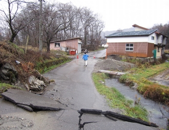
A strong earthquake (magnitude-6.7) hit northern parts of Nagano Prefecture at 10:08 p.m., November 22. DPRI updates prompt report on the field survey and research results.
Destructive landslides hit Hiroshima Asa-Kita/Minami Ward on August 20, triggered by localized torrential rains. DPRI updates prompt report on the field survey and research results.
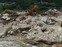
Debris flows occurred in Nagiso, Nagano Prefecture, triggered by torrential rain resulting from Typhoon No. 8. DPRI updates prompt report on the field survey and research results.
On March 22, 2014, a massive landslide occured near Oso, Washington, US due to the heavy rainfall over the past month. DPRI updates prompt report and research results.
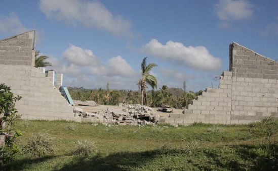
Typhoon Haiyan (T2013-No.30) was extremely intense and gave huge impact on Philippines and neighbor countries.
Landslides occured on Izu Oshima Island, triggered by the Typhoon No. 26, in Oct. 16, 2013.
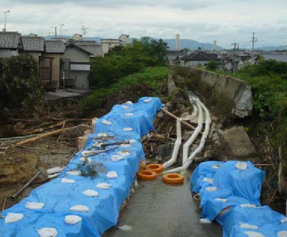
Torrential rains struck Kinki region early on Aug. 14 and brought severe damage.
The magnitude 8.6 (USGS) earthquake hit off the west coast of northern Sumatra at 2:38 p.m. (local time) on April 11, 2012.
The long-term continuous rainfall over North Thailand caused serious river floods and sediment disasters. DPRI conducts the field survey and updates the report.

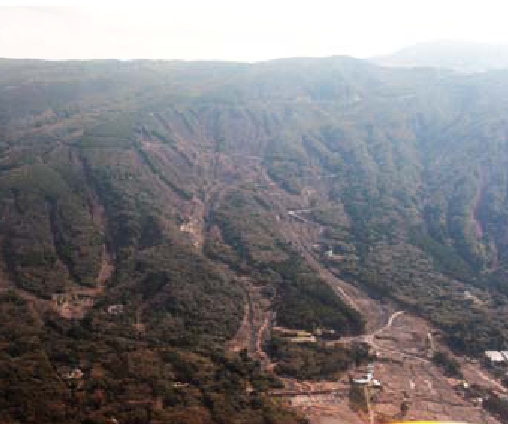
The 12th typhoon, 2011 and the heavy rain caused many disasters as flood, debris flow, landslide and collapse all over Kii Peninsula (Nara, Wakayama and Mie pref.) and the damages to the residents are enormous.
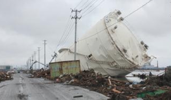
At 14:46 local time on March 11, 2011, a magnitude 9.0 (revised value by Japan Meteorology Agency on March 13) earthquake occurred off the coast of northeast Japan. DPRI continuously updates this site’s research information and analyses on the disaster.
Christchurch earthquake(Mw6.3) occured in Christchurch of New Zealand on February 21, 2011.
The 8.8-magnitude (USGS) earthquake hit Chile at 15:34 p.m. (3:34 a.m. local time) on February 27, 2010.
The September 2009 Sumatra Earthquake (Mw 7.5) occured off the western coast of Sumatra island, Indonesia, on 30, September 2009.
This is Information of the strong motion station in Sichuan Province on May 12, 2008.
In the morning on 16th, July, 2007, the Niigataken Chuetsu-oki earthquake (Mw 6.6) attacked Hokuriku district, middle northern part of Japan.
The magnitude 6.9 (JMA scale) earthquake struck Hokuriku District of main island Japan on 26 March, 2007.