IDNDR SPECIAL PROJECT
INDONESIA
I-2 Disasters Caused by Floods and Geomorphologic Changes and Their Mitigation
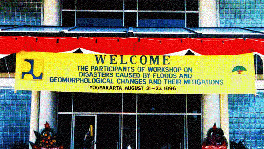
Photo 1 : Workshop venue, the Research Center for River and Sabo, Yogyakarta.
Workshop in Yogyakarta in Summer 1996
The I-2 Group for IDNDR Project held the Workshop on Disasters Caused by Floods and Geomorphological Changes and Their Mitigation (WDFGM- 1996), August 21-23, 1996, at the Research Center for River and Sabo, Yogyakarta, Indonesia. This workshop was organized by the Research Institute for Water Resources Development, the Agency for Research and Development, the Indonesian Ministry of Public Works, in cooperation with the Disaster Prevention Research Institute (DPRI), Kyoto University and conducted within the framework of the Joint Research.
The purpose of the workshop is to present and discuss the result of the joint research. Besides, other papers related to the subject were also presented. This workshop is expected to obtain a great contribution on the result of the joint research by exchanging experience and knowledge among participants.
There were ten participants from Japanese side: Prof. Takahashi (Director of DPRI). Prof. Kawata (DPRI), Prof. Egashira (Ritsumeikan Univ.), Prof. Sawai (Setsunan Univ.), Assoc. Prof. Yamashita (DPRI), Assoc. Prof. Takara (DPRI), Assoc. Prof. Fujita (Faculty of Agriculture, Kyoto Univ.), Assoc. Prof. Tanakamaru (Kobe Univ.), Dr. Yoshioka (DPRI), and Mr. Nakade (Grad. Student, Setsunan Univ.), while more than thirty from Indonesian side.
Twenty-two papers were presented including two keynote speeches by Prof. Takahashi and Mr. Napitupulu. A technical excursion to the Merapi Volcano and the Borobudour Temple was held in the afternoon on the second day.
A 253-page proceedings (ISBN: 979-8656-O1-6) including all the speeches and papers presented as well as conclusion of the workshop was published after the workshop.
The conclusion of the workshop signed by Director Takahashi and Joesron Loebis, Head of the Experimental Station on Hydrology, the Indonesian Ministry of Public Works is as follows.
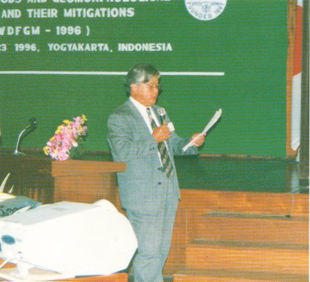
Photo 2: Prof. Takahashi giving a keynote speech.
CONCLUSION
1. JOINT RESEARCHThe result of joint research Phase-I that has been done by Indonesian and Japanese teams is useful for both sides in order to treat the meaning and knowledge of floods and geomorphological changes for their related disaster mitigation. Excellent joint research and cooperation have resulted in a workshop held on August 21 -23, 1996 in Yogyakarta, Indonesia, as well as publication of the Workshop Proceedings.
2. FLOODS
Indonesia situated in a Monsoon area has wet and dry seasons with thunderstorm climate and active volcanoes where debris flows and floods often occur, as well as urbanization and development of resources, so that some appropriate measures to cope with disasters caused by these should be included in a comprehensive development. Moreover. such topographic changes as burying of the river channels and competition of drainage areas by two rivers have often occurred and the risk of flood apparently have increased by rapid rise of the river bed in the middle reaches.
In order to reduce the loss of property and human life caused by disasters, structural countermeasures have been constructed. In addition, it is very important to strengthen non-structural countermeasures for natural disasters such as monitoring, warning, evacuating and relief systems, Further effort should be made to increase discipline, people' s awareness and participation in taking the possible danger of hazard.
3. BEACH EROSION
Beach erosion at the study area is generally resulting from the construction of the river short-cut and decreasing of the sediment supply, while the change of the river mouth was by the increase of sands. The phenomena of sediment transport in coastal area are still questionable, while the sediment discharges decrease due to the construction of check dams.
The decreasing of the sediment discharges will affect the stability of the beach at the river mouth and cause the degradation of the river bed. In order to understand the beach processes at the study area, the influence of the land (river sediment discharge), and the wave as well as the current condition should be studied in detail, with the aid of monitoring the change of the beach periodically.
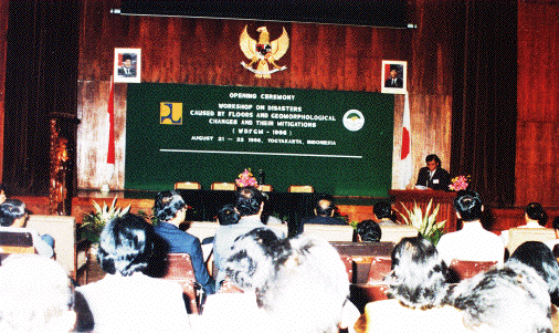
Photo 3: A scene at the Workshop.
4. FUTURE JOINT RESEARCH PLAN PHASE.II (1994-1999)
We emphasize the necessity of establishment of rainfall-runoff and sedimentation-runoff models using spatial (geographic) information obtained by satellites, aircraft, ground observations, and various kinds of maps, to make the prediction models more effective (accurate). Application of available knowledge and technology to countermeasure for debris flows, flood and beach erosion is required.
The results obtained in this joint research can also be formulated for source books, manuals, or standard procedures and guidelines. Considering that a number of data are obtained from the research, they can be used to extend the cooperation for advanced training such as post graduates in Indonesia and in Japanese Universities promoted and financed by Japanese Government or other organizations.
5. RECOMMENDATION
To obtain good research results, continuous data collection and direct discussion of the collected data are required to know whether they are in accord with the actual conditions of the areas. Examples of data that should be collected are:
a. Hourly and daily rainfall, sedimentation and discharge records for calibrating parameters of runoff model.
b. Various kinds of geographic information including satellite image. The methodologies used and results obtained in the target areas would be effectively applied to other areas in Indonesia.
 Å@
Å@
 Å@
Å@
