IDNDR SPECIAL PROJECT
I-2:Disasters Caused by Ftoods and Geomorphologic Chartges and Their Mitigation
C-1:Prediction of Strong Earthquake Ground Motions,Earthquake Disaster Prediction and Mitigation
C-3:Mechanics of Viscous Debris Flow and Countermeasures for lt
I-1:Igneous Process and Tectonics
Merapi Decade-Volcano International Workshop
Merapi Volcano, Central Java, Indonesia is one of the "Decade Volcanoes" designated by IAVCEI (International Association of Volcanology and Chemistry of the Earth's Interior)associated with IDNDR project. Merapi Decade-Volcano International Workshop was held at Yogyakarta from 5 t0 9 0ctober, 1995 by VSI (Volcanological Survey of Indonesia) and UNESCO. The workshop was attended by 79 participants from 13 countries (7 from Japan) and 72 from Indonesia. The workshop started by the field trip to see the area of pyroclastic flows on November 22,1994.
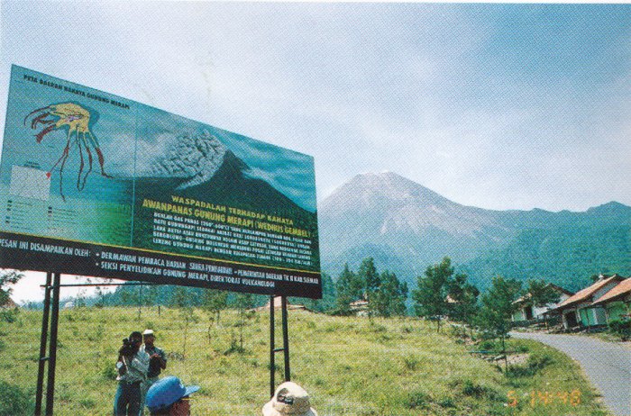
The warning b3ard in Photo was built at Kaliurang village, the famous resort place at the flank of Merapi.
The opening ceremony on October 6 was composed of Welcome address by Dr. Wimpy Tjetjep (Director of VSI), Introduction by Dr. Newhall (USGS), Opening remarks by Dr. Hashizume (UNESCO) and Opening speech by Ms. Inten Suweno (Minister of Social Affairs). 42 papers were presented concerning geophysical, geochemical, experimental, hazard, medical and social problems of Merapi. Three Indonesian researchers, Ony Suganda, Subandriyo and Edy Arsady, who studied at Kyoto University presented papers about the ground deformation, and magnetotelluric and gravimetric study of Merapi. VSI has collaborative programs with several foreign institutes. The project plans for cooperation at Indonesian volcanoes were presented from France (Institute de Protection et de Surete Nucleaire Centre d'Etudes de Saclay), Japan(Kyoto University and Tokyo Institute of Technology), USA(Pennsylvania State University), Netherlands(Utrecht University) and German(Geo Forschungs Zentrum Potsdam). The target volcano is Merapi for most of the countries. We should think how to establish the originality of our cooperation program at Merapi and other Indonesian volcanoes, The working group session is the most important. The participants were divided into 4 groups, Public education, Lahar prevention, Hazard evaluation and Dome collapse, respectively, and discussed about problems, resolution and proposals for Merapi volcano. Every evening, VSI was hospitable to all participants by Indonesian dinner and music. Dr. W. Tjetjep amused us singing many songs with "KARAOKE" orchestra.
PROJECT IN 1995
We have installed tiltmeters at the flank and near the summit at Merapi volcano. In this year, we moved the tiltmeter from the flank to the summit to reignforce the detection of ground deformation associated with dome growth. One tiltmeter was installed at the southern flank of Guntur Volcano. The tilt data are stored in the data logger. The tiltmeter is buried at the depth of 1 m to reduce the effect of temperature change. We plan to install bench marks and to conduct precise levelling. In 1994,we installed a seismic network consisting of 4 stations at the volcano.
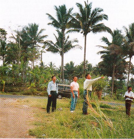
The observation data revealed hypocentral zone from beneath the summit to western part. In this December, we conducted a temporary seismic observation to determine precisely the hypocenter and focal mechanism to make clear the structure and state of stress of the volcano. From viewpoint of studying static deformation of the Guntur area caused by volcanic activity, we searched for suitable places for GPS monitoring in and around the epicentral area in September 1995 together with DPRI, ITB(Bandung Technological Institutes) and VSI. And we could find several points for GPS station in the area. For example, one of them is beside the crater of the volcano, and another is near Kamojang geothermal zone where there is a big powerplant using terrestrial heat, in the western part of Guntur mountains (Photo). If everything goes well, we win be able to start GPS monitoring of the volcanic activity of Guntur in 1996.
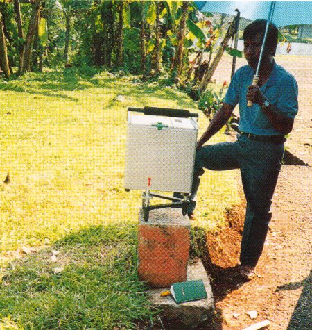
International gravimetric connection along the route of Japan-Singapore-Indonesia as well as domestic one in Indonesia were carried out with a SCINTREX CG-3M Gravity Meter during the period from September 4 to October 3,1995.We made similar gravity measurements at the same gravity stations in 1993 and in 1994(Photo).
The purpose of this gravimetric connection is to improve reliability of the gravity values at the Primary Base Station for Indonesia(DG.O Bandung) and at other gravity stations which were mainly composed of GPS stations established in 1991 for the purpose of monitoring activities of the faults and volcanoes in west Jawa in cooperation with DPRI and ITB. There is a base (calibration) line with 275 mgals gravity difference from Bandung to Subang (around 40 km north-east of Bandung), established by BAKOSURTANAL(National Coordination for Surveys and Mapping in Indonesia) for the purpose of calibrating scale constants of gravimeters.
We also made precise gravity measurements along this line again. This line passes the flank of Tang-kubanperahu volcano. If we repeat precise gravity measurements hereafter, we will be able to distinguish the gravity change caused by the volcanic activity of the mountain.