SYMPOSIUM ON JAPAN-INDONESIA IDNDR PROJECTS
-Volcanology, Tectonics, Flood and Sediment Hazards-
Disaster Prevention Research Institute (DPRI) of Kyoto University has conducted two successive projects in the framework of the International Decade for Natural Disaster Reduction (IDNDR): "Study of Prediction and Mitigation of Natural Disasters in Eastern Asia (Indonesia and China)" during 1991-1993 and "Prediction and Mitigation of Natural Disasters in Indonesia and China" in 1994-1998. The main subjects in Indonesia were Igneous Process and Tectonics (I-1 group) and Disasters Caused by Floods and Geo-morphological Change and Their Mitigation (I-2 group). The two groups planned the joint symposium to exchange their findings and summarize their projects and to improve strategies, methodologies and techniques with Indonesian counterparts.
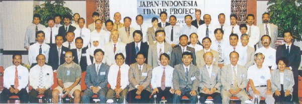
The symposium was held on September 21 - 23, 1998 at Holiday Inn Hotel in Bandung, Indonesia. It gathered more than 200 participants. One hundred and seventy-six Indonesian researchers were from Volcanological Survey of Indonesia (VSI), Bandung Institute of Technology (ITB), Research Center for River and Sabo, and Research Institute for Water Resources Development. Twenty-six Japanese scientists were from DPRI, Graduate Schools of Science and Agriculture of Kyoto University, Tokyo Institute of Technology, Ritsumeikan University, Kobe University, and Setsunan University. The symposium was started by the opening speeches by Dr. R. Sukhyar, Chairman of Organizing Committee (Director of VSI), Prof. Hirotake Imamoto (Director of DPRI) and Ir. Darmoko Slamet (Director General of Geology and Mineral Resources). The fruit of Japan-Indonesian collaborative studies was summarized by five keynote speakers; Ir. Joelianto Hendro Moeljono (Director General of Agency for Research and Development), Prof. Torao Tanaka (DPRI), Prof. Shinji Egashira (Ritsumeikan University), Prof. Joenil Kahar (ITB) and Dr. Wimpy Tjetjep (VSI).
Fifty-one papers were presented on volcanology, tectonics, beach erosion, flood and so on. It was reported that many kinds of observation were made at Guntur volcano in the crisis of 1997 activity and new techniques were introduced to study volcanology and tectonics. Various kinds of problems in Indonesia were introduced through case studies. Research results were presented based on collaborative field observations in the Brantas River basin and coastal zones. Some papers dealt with mathematical models for river bed variation, rainfall-runoff, sediment transport, and beach erosion. A lot of discussions and comments were made in general sessions. In the dinner parties on 21 and 22, participants enjoyed traditional Sundanese dance and modern KARAOKE.
In the afternoon on 23, workshops were respectively held by I-1 and I-2 groups. I-1 group will extend collaborative study by reinforcement of observation technique such as water-tube tiltmeters and infrasonic microphones, and combination of observation in volcanic and tectonic regions by seismic, gravimetry and GPS observations. I-2 group came to a proposal that the re-search on sediment yield and runoff prediction should be continued as a collaborative one. Possibility of initiating new research projects was discussed in terms of other topics such as frequency analysis of floods and droughts and the effects of ENSO (El Nino and southern oscillation) phenomenon on water resources and water-related disasters. The common issue to conduct these research topics is how to get financial resources.
The symposium was closed by the speeches by Mr. Aoshima (UNESCO, Jakarta office) and Prof. Kazuhiro Ishihara (DPRI). The proceedings of the symposium will be published in March 1999.
Activities of I-1 group in 1997-1998
Guntur Volcano
Since the installation of seismic stations at the volcano in 1994 October, less than volcanic earthquakes had occurred per month. In May 1997, the seismicity suddenly increased and 55 earthquakes occurred. Tiltmeter also showed inflation of the ground around summit crater at the same time. The high level of seismicity continued and continuous volcanic tremor appeared in August. Increase in seismicity and inflation of the crater area usually are considered to be precursors of volcanic eruptions and Volcanological Survey of Indonesia issued Alert Level 2 (Caution) on the activity of Guntur and sent weekly report on the activity to local government in Garut area. The seismicity attained peak in October and 108 earthquakes were recorded in October, and the seismicity gradually decreased and returned to normal level in February 1998.
In response to this crisis, Volcanological Survey of Indonesia (VSI) and DPRI con-ducted the following observations: 1) New permanent station was installed at the summit crater. 2) 4 temporary seismic stations were installed with data loggers or telemetry system. Unfortunately, some stations were burnt by the serious fire in Indonesia as newspapers reported in 1997. 3) Precise leveling was conducted in August and November 1997 and the measurement also showed inflation of the summit crater. The leveling survey was repeated in June and December 1998. 4) GPS measurement was repeated in February, June and October 1997 around Guntur volcano in cooperated with Bandung Institute of Technology.
Other volcanoes
Temporary seismic observations by using data loggers were conducted at Sangeanapi (February 1997), Slamet (March 1997), Krakatau (June 1997), Gede (August 1997) and Papandayan volcanoes (June-August 1998). The precise hypocenter distributions and focal mechanisms were made clear at these volcanoes. 2) Continuous GPS observation started at Tangkupanparahu, Gedeand Papandayan volcanoes to detect tectonic stress field in West Java.
Merapi Decade Volcano Workshop II
Merapi volcano is designated as one of Decade volcanoes where IAVCEI recommended to demonstrate to plan of activity cooperation with IDNDR. VSI and UNESCO held second workshop for the volcano in December 1997. Prof. Ishihara attend the meeting.
Activities of I-2 group in 1997-1998
The Brantas River basin
Based on sampling bed materials at about thirty points in the basin, the soil property and particle size were investigated. One- and two-dimensional bed variation models were constructed for the middle reach of the Brantas. The 1-D model investigated the effect of channel width on bed variation and the effect of suspended load and revealed that the rapid change in channel width causes greater river bed variation, which is critical for flood hazard. The 2-D model expressed the stream bifurcation process in the river and verified that river bed variation becomes greater and the particle size at the inner side becomes greater when taking the suspended load into account.
Remote sensing images and geographic information systems (GIS) are used for establishing a distributed hydrological model for flood and sediment runoff. The model applied to the Putih river, one of the major tributaries, reproduced the sediment yield during seven years after the 1990 eruption of Mt. Kelud and estimated the effective infiltration depth that contributes sediment yield.
A long- and short-term rainfall-runoff model was also constructed for the analysis of water balance and prediction of runoff discharge in the Sutami reservoir basin. This model can reproduce daily rainfall-runoff, using the VIC (variable infiltration capacity) model.
Studies of coastal and sea bottom topography changes
The following researches has been conducted intensively this year.
(1) One-year simulation of tide- and wind-driven circulation in Java Sea, which is influenced by west- and east-monsoon, was carried out using a three-dimensional hydrodynamics model incorporating the influence of waves. A third-generation ocean wave prediction model, WAM, was employed to calculate the wave fields and the wave-dependent sea surface and bottom drag coefficients. Six hourly-wind field at 10 m above the sea surface were given by ECMWF's global climate reanalysis data as a representative wind. Trajectory of numerical tracers for one-year circulation was simulated to make clear transportability of materials at both the sea surface and bottom.
(2) Three-dimensional beach change prediction model which consists of bore type breaking wave model, 3-D nearshore circulation model and sediment transport model, has been developed in this project. Its verification has been continued in coasts both in Japan and Indonesia.
(3) Coastal monitoring and numerical prediction have been conducted in Pangandaran coast (South Java) facing the Indian Ocean, where the river short-cut works are under construction.