
From HEIFE to GAME
-International Cooperative Research Projects Related with WCRP-
WCRP: The principal planning and coordinating mechanism for climate research throughout the world is the World Climate Research Programme (WCRP), which aims to determine the extent to which climate can be predicted, and the extent of human influx on climate.
WCRP is jointly sponsored by the World Meteorological Organization (WMO) and the International Council of Scientific Unions (ICSU).
HAPEX: At the First Informal Planning Meeting of WCRP at Geneva, 1986, a series of Hydrological Atmosphere Experiments (HAPEX) were discussed and approved.
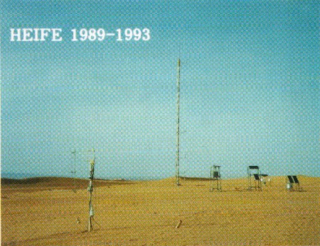
HEIFE: The HEIFE (Heihe River Field Experiment) is the third undertaking of HAPEX, specially designed in the arid and semi arid regions involving desert, which was first proposed by the Prof. Ye, Duzheng, the chairman of Chinese Climate Research Committee (CCRC). After negotiation between CCRC and Japanese WCRP Committee, HEIFE was decided to execute as a Sino-Japanese Cooperated Research Program on Atmosphere-Land Surface Process Experiment in the Heihe River Basin, 1989Å`1993, jointly sponsored by the Chinese Academy of Science, the National Natural Science Foundation of China, the Lanzhou Provincial Academy of Science, and the Japanese Ministry of Education, Science, Sports and Culture.
The objectives of HEIFE are as follows:
 (1) To improve the understanding of land surface processes in the semi arid area ranging from a few kilometers to 100 km.
(2) To test parametric formulations of evaporation, ground water level and others in climate models.
(3) To provide a meaningful physical basis for developing and testing new conceptual models of surface hydrological processes.
(4) To aid the interpretation of remote-sensing data by providing reference in-situ measurement.
(5)To establish a data-base of land surface processes in the semi arid area for further studies.
The Heihe River basin is in the Hexi corridor between the Qilian mountains and the Longshow mountains in Gansu Province, China. The Heihe River rises in glaciers of the Qilian mountains, and flows from southeast to northwest through the corridor, and disappears in the Mongolian desert. The surface of the basin is basically the sand desert or Gobi(rock desert), but there are scattered oases and irrigated farmlands along the river.
Five basic stations were set up during the HEIFE period, at which vertical profiles of wind, temperature and humidity, profiles of soil temperature, upward and downward fluxes of short- and longwave radiation, and other meteorological and hydrological entities were continuously recorded. Five automatic weather stations were also established as supplement to these.
Precipitation was monitored by existing and additional rain gauges. Hydrological data such as discharge of Heihe River and ground water level were also monitored. Several Intensive Observation Periods (IOP's) for a few weeks were executed for sophisticated observations. During these IOP's, the following observations were performed, i.e., tethered balloon sounding, low-level sonde sounding, upper wind sounding by Doppler sodar, measurement of atmospheric turbulence, observation of sand transport in the lower atmosphere, chemical analysis of soil and water samples, measurements of CO2 transport in the plant canopy, measurement of evaporation from the crops, observations of aerosols and ozone, sounding of precipitation particles by video-sonde, etc.
The Disaster Prevention Research Institute(DPRI) has acted as the center of Japanese side in HEIFE, and many researchers from the Severe Storm Research Section, the Applied Climatology Research Section, the Water Resources Research Center and the Shionomisaki Wind Effects Laboratory of DPRI participated in it.
AECMP: The HEIFE was terminated in 1993.
However, participants of International Symposium on HEIFE have concluded that this type of research program should be continued to monitor the climate changes as long as possible. Thus more than half of the routine observations of HEIFE are continued under the Arid Environment Comprehensive Monitoring Project sponsored by International Cooperative Research Fund.
AECMP will end by the end of March 1996. After that it will be succeeded by a new and larger International Research Program called GAME in the frame of GEWEX.
GEWEX: A subprogram of WCRP, that concerned predominantly with the fast component of the climate system, Global Energy and Water Cycle Experiment (GEWEX) aims to determine global distribution of water and energy fluxes from observations and to compute their values from predicted atmospheric properties, for the purpose of quantifying the energetic processes in the earth's climate system and atmospheric forcing of the ocean, land, ice and vegetation. The four objectives of the GEWEX program are:
(1)To determine the hydrological cycle and energy fluxes by means of global measurements of observable atmospheric and surface properties;
(2)To model the global hydrological cycle and its impacts on the atmosphere, ocean, and land-surface.
(3)To develop the ability to predict the variations of global and regional hydrological processes and water resources, and their response to environmental change.
(4)To foster the development of observing techniques, data management and assimilation systems suitable for operational application to long-range weather forecasts, hydrology and climate predictions.
GAME: A sub-program of GEWEX in regional continental-scale for Asian continent has been organized by related countries as GAME(GEWEX Asian Monsoon Experiment), This project aims to clear the contribution of Asian Monsoon on the global climate changes in the same idea as GEWEX, and will be started in 1996 sponsored by the Ministry of Education, Science, Sports and Culture, and the Science and Technology Agency for the Japanese side.
GAME will be executed in the following way; 1)Monitoring by satellite and in-situ surface observations, 2)Process studies based on the four regional experiments(Tropics, Sub-tropics, Tibetan Plateau and Siberia), 3)Modeling of hydro-meteorological processes in the climatic system.
The members of DPRI are to participate in this program especially in the field experiments in subtropical China(Water Resources Research Center) and Tibetan Plateau(Severe Storm Research Section).


