
 |
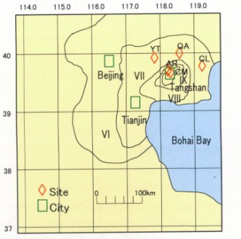
On 28 July 1976, a destructive earthquake struck the city of Tangshan,in mainland China,160 Km east of Beijing. The focal depth of the Ms=7.8 Tangshan earthquake was 10 Km. A prominent surface rupture crossed the city, almost completely destroying it and heavily damaging the surrounding areas. |
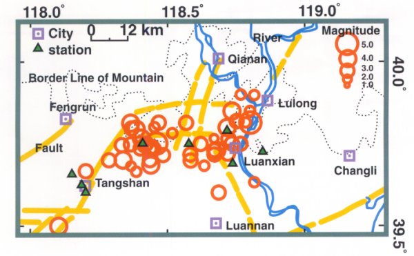 |
| Seismic observation network fot strong motion deployed in Tangshan area and earthquake epicenters observed. |
 |
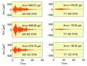 |
| Seismic intensity map | Reproduced seismograms(AR:seriously damaged area,YT:slightly damaged area) |
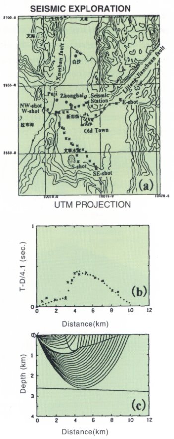
| Earthquake Risk Assessment of Urban Region on Soft Soil Sediments: DPRI,Kyoto University and Seismological Bureau of Yunnan Province,China conducted array-observations of long-period microtremors, seismic-refraction and gravity explorations to investigate the subsurface structure of Lijiang basin, Yunnan. Special attention was given to the relation between the configuration of bedrock and the anomalous distribution of damage to wooden houses and RC buildings in the basin caused by the 1996 Lijiang Earthquake(M7.0, Feb.3). The analyses show that, the bedrock subsides steeply along the west edge of basin, where runs the Xueshan fault: a probable seismogenic fault of the 1996 Lijiang Earthquake, suggesting that, the configuration of bedrock affects strongly the ground motions, consequently the anomalous distribution of damage. This situation reminds us of the similar damage distribution in Kobe-Hanshin area by the 1995 Kobe earthquake. In consequence, it is impossible to overemphasize the importance of the study on 3D-config-uration of bedrock for microzoning edimentary basins. Topographical map ofLijiang basin and location of seismic exploration profiles(a), Comparison betweenobserved(X) and calculated(+) P-wave travel times fromNW-shot for NW-SE profile(b) and model for bedrockand ray diagram(b). Note the steep subsidence of bedrockup to 700m at the west of basin. |
 |

